Blue River, Colorado River, and Gore Creek
Blue River
- North from the Dam at Dillon Reservoir (near
Silverthorne) to Hamilton Creek Road
- AND from Green Mountain Reservoir to confluence with
the Colorado River near Kremling
- Colorado Hwy 9 follows the Blue for much of the 34 miles, with access points
- Entire segment is fly and lure only; Gold Medal sections are catch and release on trout; other
portions are 2 trout limit with minimum size of 16". Check regs for section(s)
you are fishing.
- View stories & pictures Blue River
Colorado River
- From Fraser River west to Troublesome Creek (east of Kremmling).
- US Hwy 40 follows the Colorado for this section
- Check regs for portion youa re fishing - regs vary along this stretch.
-
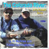 Buy a paperback or ebook on The Colorado River: A Fly
Fisher's Guide by Al Marlowe and Karen Christopherson which
includes color maps and info on the Colorado and its main
tributaries (Blue, Eagle, Fraser, Roaring Fork, Fryingpan and
Fraser). The book is over 170 pages and includes info on
access, flies, hatches, and more.....available from
Barnes and Noble Or
on Amazon
Buy a paperback or ebook on The Colorado River: A Fly
Fisher's Guide by Al Marlowe and Karen Christopherson which
includes color maps and info on the Colorado and its main
tributaries (Blue, Eagle, Fraser, Roaring Fork, Fryingpan and
Fraser). The book is over 170 pages and includes info on
access, flies, hatches, and more.....available from
Barnes and Noble Or
on Amazon
Gore Creek
- From Red Sandstone Creek to the Eagle River (downstream), west of Vail.
- I-70/US Hwy 6 follows the creek.
- Flies and lures only; bag/possession = 2 trout, 16" or greater.