

South Platte River
The South Platte - Cheesman downstream
- North (downstream) from Cheesman Reservoir Dam, to upper boundary of Wigwam Club AND
- From lower boundary of Wigwam Club to Scraggy View Picnic Ground
- Use Hwy 67 and other road access for Gold Medal portion of river;
the Gill Trail is the access for Cheesman Canyon - Story and pictures - the South Platte from Deckers through Waterton Canyon
- Story and pictures - Fishing Cheesman in Winter
- Info on the Gill Trail from Pike National Forest
The South Platte - South Park area
- From confluence of Middle and South forks to Spinney Mountain Reservoir
- Middle Fork: From Hwy 9 bridge (north of Garo) to confluence with South fork
- From Spinney Mountain Reservoir outlet to Eleven Mile Reservoir (the "Dream Stream")
-
 Buy South Platte Downloadable Digital Fishing Maps
Click here for info or to purchase.
Buy South Platte Downloadable Digital Fishing Maps
Click here for info or to purchase.
Spinney Mountain Reservoir
- Located on the South Platte River, south of US Hwy 24 and southeast of Hartsel
- Story and pictures - Spinney Mountain Reservoir
- Click for link to CO Parks and Wildlife site on Spinney Reservoir
 Click
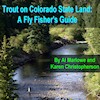
here to buy an Ebook about Trout on Colorado
State lands - includes a lot of info about 150 Colorado fishing lakes and streams
Click
here to buy an Ebook about Trout on Colorado
State lands - includes a lot of info about 150 Colorado fishing lakes and streams
Buy South Platte Downloadable Digital Fishing Maps
Click here for info or to purchase.